• How do I
    • Access
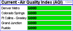
      • Air quality
      • Board agendas
      • Board meetings
      • Building permits
      • County calendar
      • Foreclosures
      • GIS maps
      • Marijuana regulations
      • News releases
      • Property values
    • Apply for
      • Building permits
      • Child care assistance
      • Child Support
      • Public Assistance
      • Job openings
      • Liquor licenses
      • Marriage licenses
      • Retail food licenses
    • Get a copy of
      • Birth certificates
      • Death certificates
      • Marriage licenses
      • Land use applications
      • Procurement contracts
    • Pay for
      • Child support
      • Property taxes
    • Register
      • To foster/adopt
      • Vehicles
      • To vote
    • Report
      • Child abuse
      • Code violations
      • Welfare fraud
    • Request
      • Open records
    • Contact
      • Garfield County
  • Offices
    • Elected offices
      • Assessor
      • Board of County Commissioners
      • Clerk and Recorder
      • Coroner
      • District Attorney
      • Sheriff
      • Surveyor
      • Treasurer
      • Public Trustee
      • Elected officials
    • Departments
      • Administration
      • Airport
      • Attorney
      • Communications
      • Community Development
      • Courts
      • Criminal Justice
      • Emergency Management
      • Environmental Health
      • Fairgrounds & Events Center
      • Finance
      • Geographic Information System
    •  
      • Human Resources
      • Human Services
      • Information Technology
      • Landfill
      • Oil and Gas
      • Procurement
      • Public Health
      • Public Lands Access
      • Road and Bridge
      • Vegetation Management
      • Veteran Services
      • All locations
  • Towns
    • Carbondale
      • Town of Carbondale
      • Demographics
      • Map
    • Glenwood Springs
      • City of Glenwood Springs
      • Demographics
      • Map
    • New Castle
      • Town of New Castle
      • Demographics
      • Map
    • Parachute
      • Town of Parachute
      • Demographics
      • Map
    • Rifle
      • City of Rifle
      • Demographics
      • Map
    • Silt
      • Town of Silt
      • Demographics
      • Map
    • Battlement Mesa
      • Battlement Mesa community
      • Demographics
      • Map
    • Garfield County
      • About Garfield County
    • Community
      • Human Services Commission
      • Community agencies
  • Business
    • Business here
      • Building applications
      • Building inspections
      • Demographics
      • Economic Development
      • Parcel maps
      • Planning applications
      • Property search
      • Food safety
      • Useful Public Service
    • Licenses and permits
      • Building permits
      • Childcare licensing
      • Driveway permits
      • Liquor licenses
      • Overweight trucks
      • Utility permits
    • Taxes
      • Abstract of assessment
      • Pay property taxes
      • Property search
      • Taxing entities
  • Seniors
    • Long term care
    • Lunch menu
    • Nutrition program
    • Senior programs
    • Senior tax deferral
    • Senior tax exemptions
    • Veteran Services
  • Online
    • Apply for jobs
    • Explore live maps
    • Search foreclosures
    • Property search
    • Search property taxes
    • Search public records
Garfield County logo
Vegetation Management


G A R F I E L D    C O U N T Y,   C O L O R A D O

Vegetation Management

Home
/
Perennial Pepperweed

Perennial Pepperweed

(Lepidium latifolium)

perennial pepperweed flower
Leslie J. Mehrhoff, University of Connecticut, Bugwood.org
perennial pepperweed plant
Pedro Tenorio-Lezama, Bugwood.org

Also known as tall whitetop, this perennial weed was brought into the country as a contaminant of sugar beet seeds. It grows from 2 to 4 feet tall with white flowers in rounded clusters on the ends of the branches. Leaves are oblong and smooth with toothed edges and a white midrib. This plant uses its extensive root system to draw salts from deep in the soil.

The salt is then exuded from the leaves and is deposited on top of the soil where it can inhibit other plant growth. Pepperweed is usually found in moist areas such as wetlands, riparian areas, ditches and seasonally flooded areas. It can be found scattered throughout central to western Garfield County, with the largest infestation being along Parachute Creek.

Pages
  • Garfield County
  • Vegetation Management
  • Documents & forms
  • Do not spray
    requests
  • Mosquito control
  • Noxious weed list
  • Noxious Weed Advisory Board
  • Noxious weed cost share
  • Noxious weed law enforcement
Vegetation Management

Garfield County Vegetation Management


195 West 14th Street, Building D, Suite 310
Rifle, CO 81650
Map

Email Vegetation Management

970-945-1377, ext. 4305 | phone
970-625-5939 | fax

© Garfield County | contact us | locations | privacy policy

Top photo by Todd Patrick.
X