Clean air over Glenwood Springs, Colorado

Monitoring shows good air quality in Garfield County

PRESS RELEASE
August 19, 2021

Garfield County’s ambient air monitoring program found that most volatile organic compounds are declining in the area and no national ambient air quality standards (NAAQS) violations for ozone or particulate matter were reported in 2020.

In 2020, Garfield County experienced 335 days of good air quality over a 24-hour period for particulate matter (PM) of 2.5 microns (PM2.5), with 26 moderate days, and just four days considered unhealthy for sensitive groups, according to a report prepared by Air Resource Specialists. The county also measured 258 days of good air quality for eight-hour ozone, with 103 in the moderate category and just five in the unhealthy for sensitive groups level.

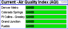
Air Quality Index (AQI) is the standardized system that state and local air pollution control programs (including Garfield County) use to notify the public about levels of air pollution. The AQI provides six different levels of air quality: good, moderate, unhealthy for sensitive groups, unhealthy, very unhealthy, and hazardous.

The “good” level indicates that air quality is considered satisfactory and air pollution poses no significant risk. The “moderate” level indicates that air quality is acceptable, but that some pollutants may pose a moderate risk for a very small number of people (those who are unusually sensitive to ozone may experience respiratory symptoms). The third air quality level observed in Garfield County in 2020, “unhealthy for sensitive groups,” indicates that members of sensitive groups may experience health effects due to air pollution.
This could include people with lung disease, who are at greater risk from exposure to ozone, or people with either lung disease or heart disease, who are at greater risk from exposure to particle pollution. The general public is not likely to be affected when the AQI is in this range.

A NAAQS violation for particulate matter registers if the three-year average of the 98th percentile of 24-hour air quality is greater than 35 micrograms per cubic meter of air (µg/m3). Any level over 35 µg/m3 places the area in the “unhealthy for sensitive groups” category, which includes people with respiratory illnesses. The county was below this threshold in 2020, despite particulate levels being up in 2020 due to the Pine Gulch and Grizzly Creek wildfires.

Particulate matter with sizes smaller than either 2.5 or 10 microns are regulated by the Environmental Protection Agency (EPA), and typically consist of solid particles and liquid droplets small enough to be inhaled. The width of a particle defined by PM2.5 is roughly 30 times less than a strand of hair.

An ozone violation occurs when a three-year average of the fourth highest daily maximum eight-hour average exceeds 70 parts per billion (PPB). While ozone levels in Carbondale and Battlement Mesa registered above the NAAQS standard in 2020, the three-year average is still below the threshold.

“In 2020, we did have a spike in ozone days that put us over the threshold for the ambient air quality standard,” said Garfield County Environmental Health Specialist Ted White. “But overall, Garfield County air quality was below that range and in a good place.”

This past year, the county program monitored air quality at five sites, including Parachute, Battlement Mesa, Rifle, Carbondale, and Bell Ranch, which is south of Silt.

“On the website, we provide real-time data from our Rifle, Carbondale and Battlement Mesa sites,” White told the Board of County Commissioners. “The Rifle site provides monitoring of ozone and PM2.5, as well as a live feed camera. We monitor for ozone at the Carbondale, Rifle and Battlement Mesa sites, and nitrogen dioxide at the Battlement Mesa site. Particulate matter is monitored at the Rifle and Battlement Mesa sites. All our previous air monitoring reports are available online.”

VOCs declining in Garfield County
Volatile Organic Compounds (VOCs) have been measured in Garfield County since 2008, and monitoring shows a diminishing trend in the area.

Ninety different compounds are analyzed, including 21 hazardous air pollutants, such as propane, benzene, formaldehyde, and ethane, and contribute to ground-level ozone formation, which occurs as a chemical reaction when pollutants are exposed to sunlight. VOC monitoring took place via the county’s mobile monitor in Battlement Mesa, as well as through canister sampling at the Rifle, Parachute, and Bell Ranch sites.

“While we’re still monitoring VOCs in Battlement Mesa, we’ve discontinued sampling in Carbondale,” White said. “We just weren’t seeing anything that really warranted continued monitoring there.”

The EPA lists common criteria air pollutants, such as carbon monoxide, lead, ground-level ozone, particulate matter, nitrogen dioxide, and sulfur dioxide, in its NAAQS. The local measured values are compared to EPA standards for three pollutants, including ground-level ozone, nitrogen dioxide, and particulate matter.

More detailed information on the program’s findings is available at garfield-county.com/air-quality/documents.

Leave a reply